


Establishment details
Rest area
- Rest area slope(%) : 25
Trail-Elevation
- General elevation change on route : more than 6%
- Steep slope-Percentage(%) : more than 12%
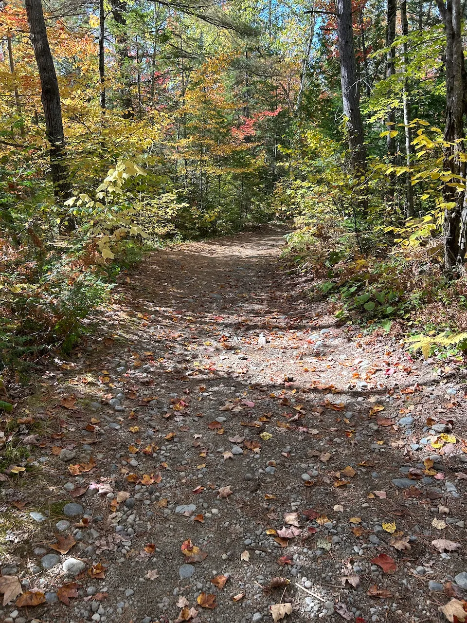
Trail-Surface
- Main surface type : hard-packed earth
- Presence of obstacles : rocks
Trail
- Length(km) : 0,5
- Average trail clear width (cm) : under 100 cm
Additional Information
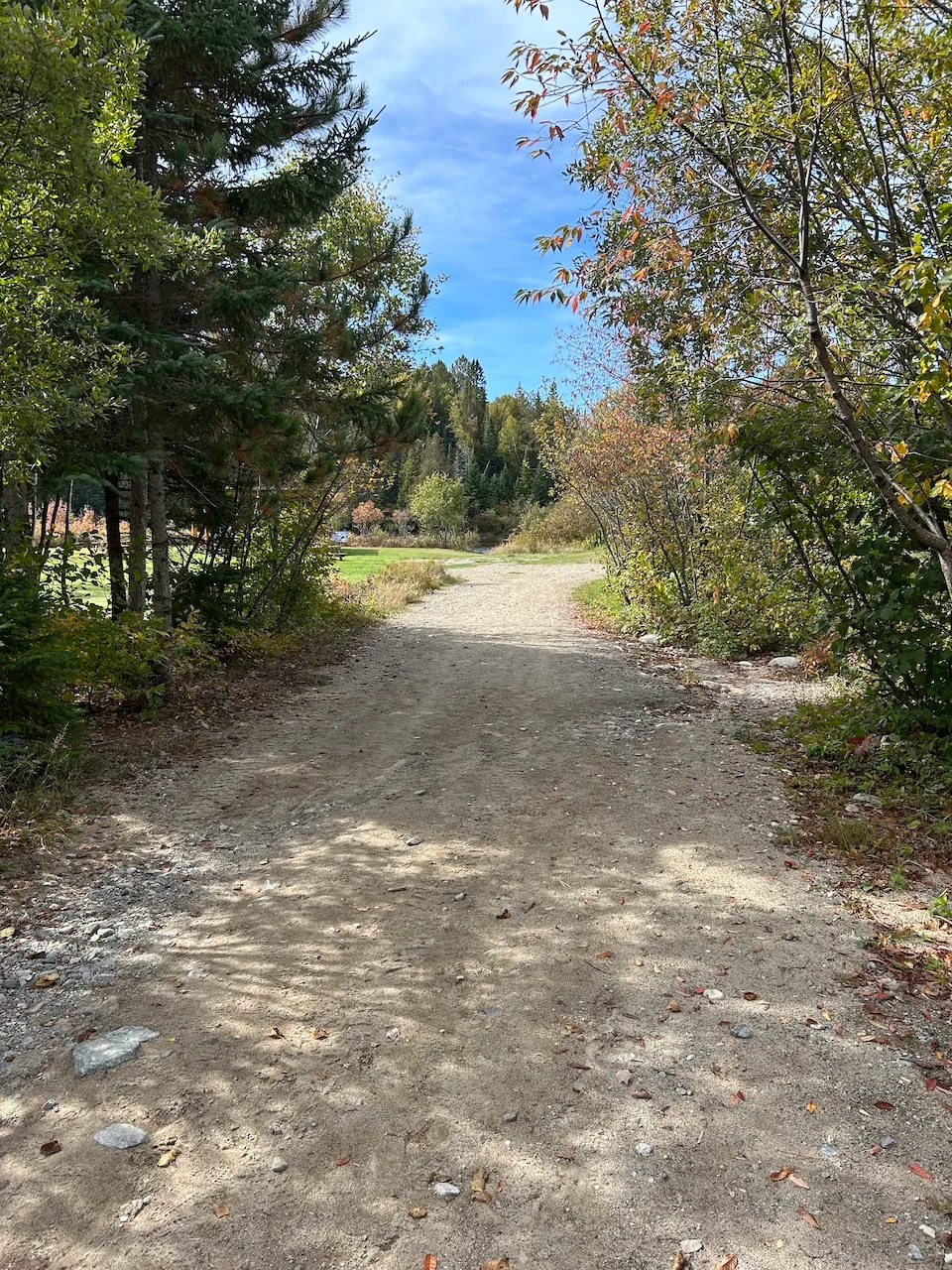
Access to the trail is from parking lot P4. It is a linear trail leading to the Contrefort sector.
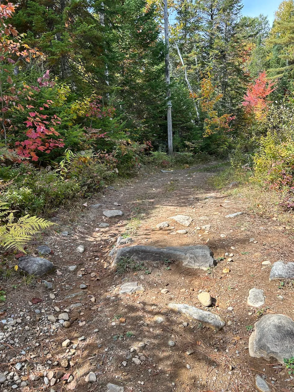
There is a rest area at the trailhead offering a view of the Ouareau River. From the parking lot to the river and this rest area, the trail is covered with large gravel, has no slope, and is relatively wide, making it partially accessible.
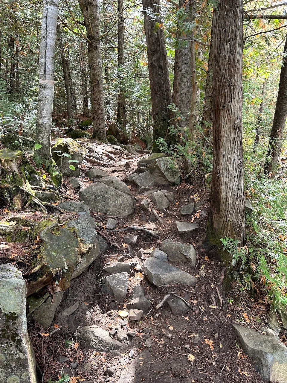
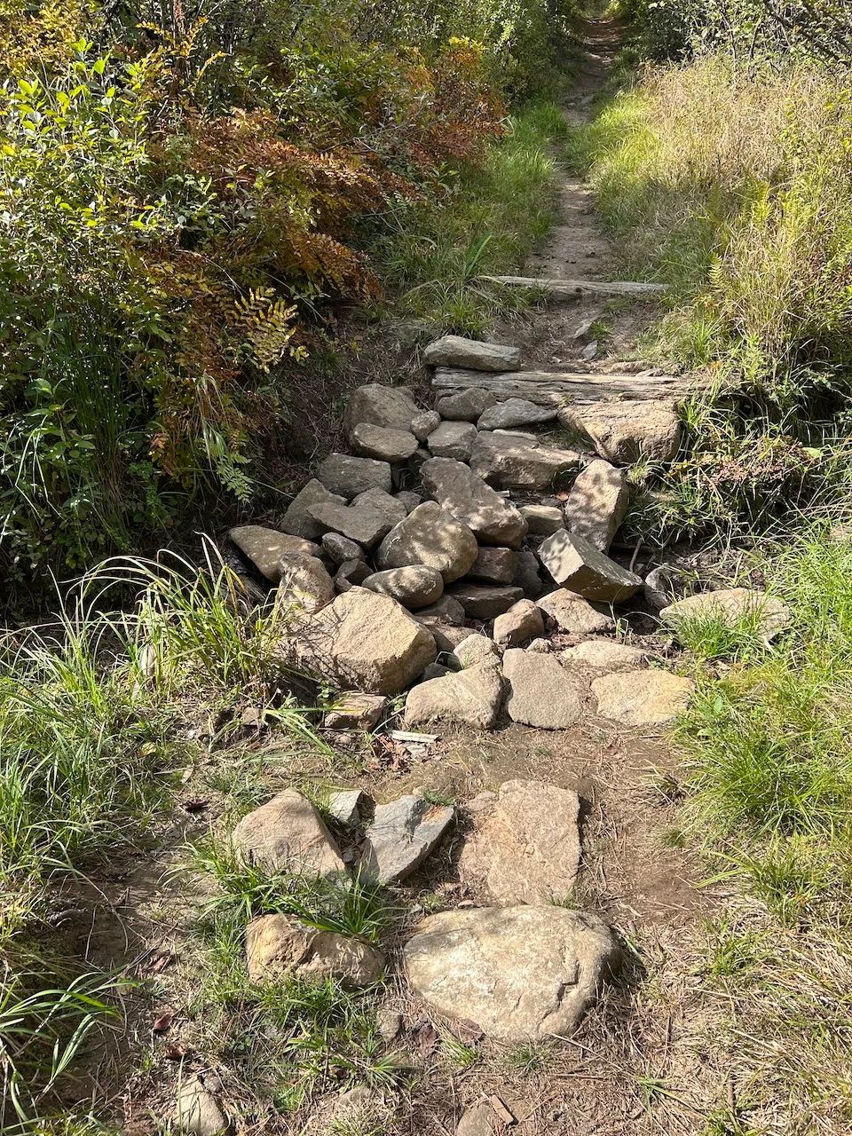
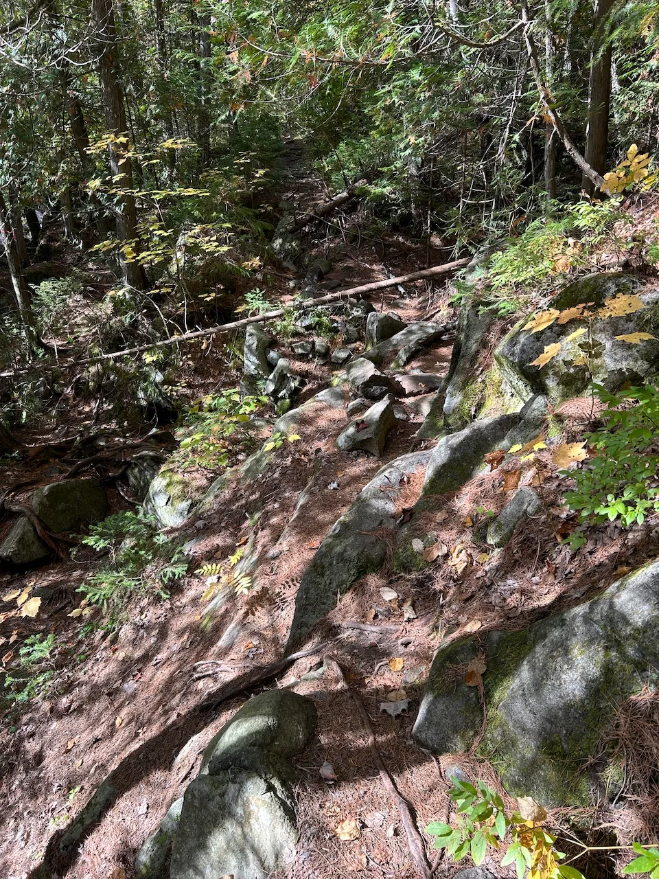
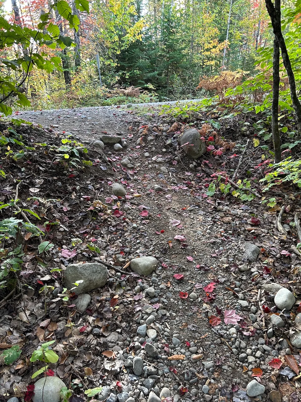
The width of the trail varies along its length and becomes very narrow in some places. The trail has many obstacles, including sand, large rocks, and roots. There are also bridges and bollards that narrow the passage to 38 cm. There are slopes of up to 30% and several sections require stepping over large rocks.
Rest area
- Table(s) available : yes
Directional signage
- Site map showing accessible services/routes : no
- Raised elements present : no
- Braille present : no
Additional Information
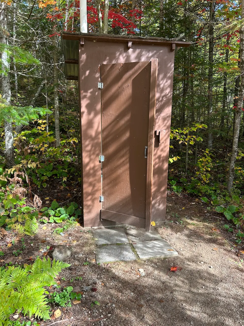
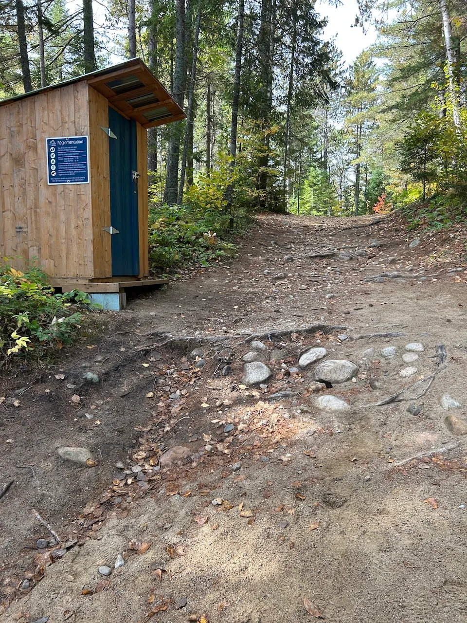
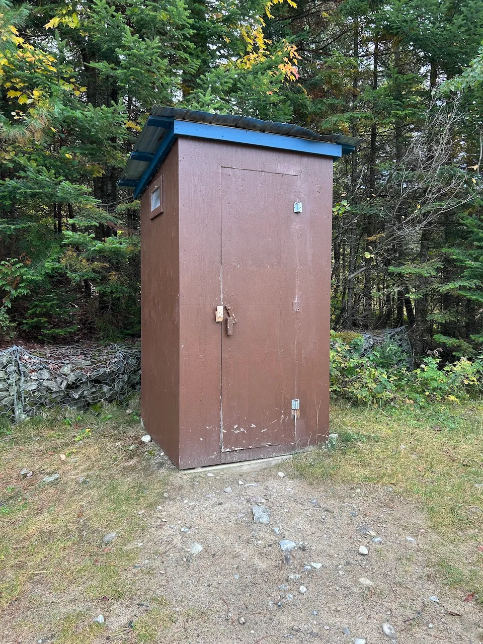
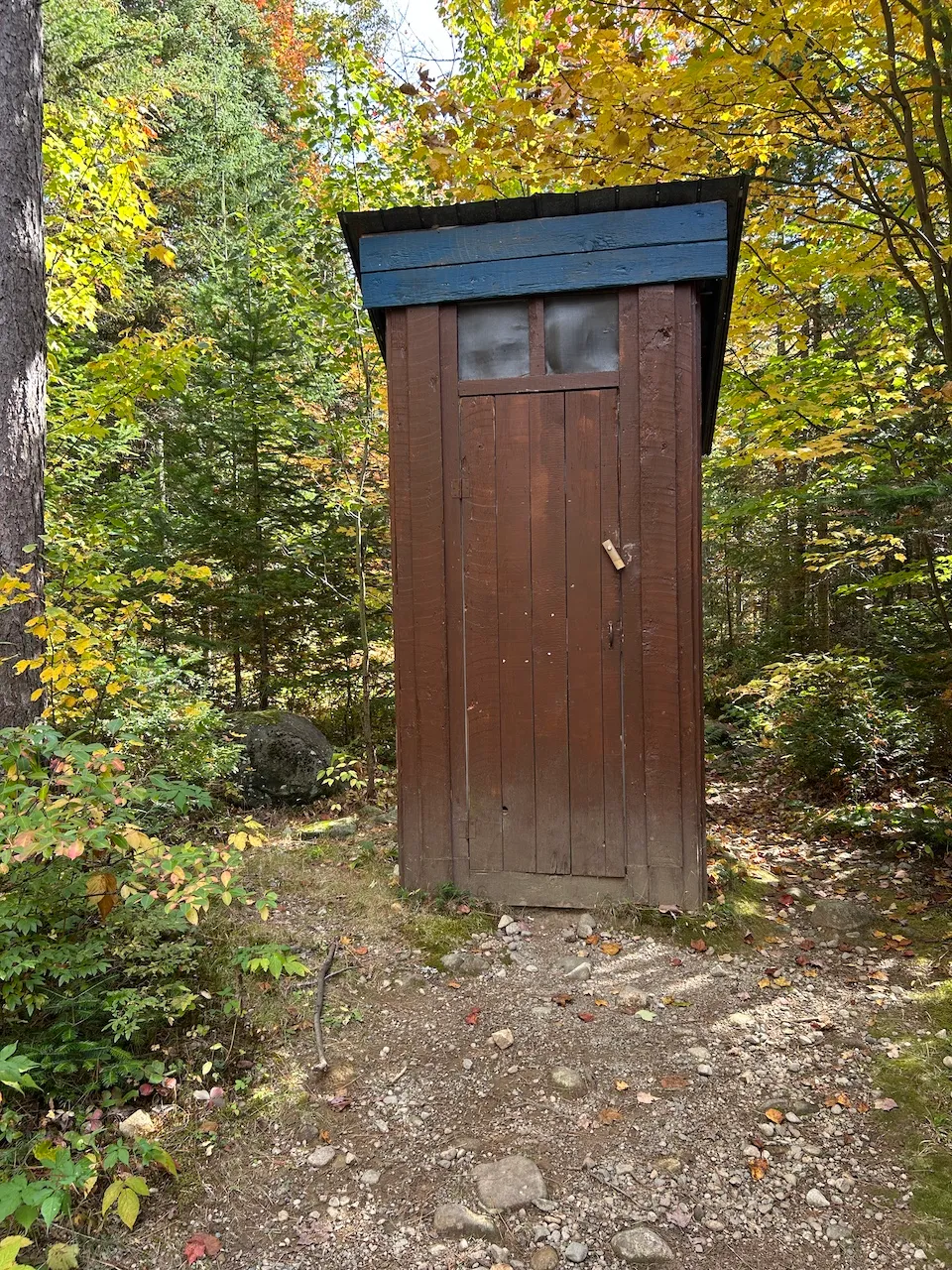
Several dry toilets are located at various points around the site, generally near trailheads. None of them are accessible, as they all have thresholds and no grab bars. There are no accessible picnic tables anywhere on the site.
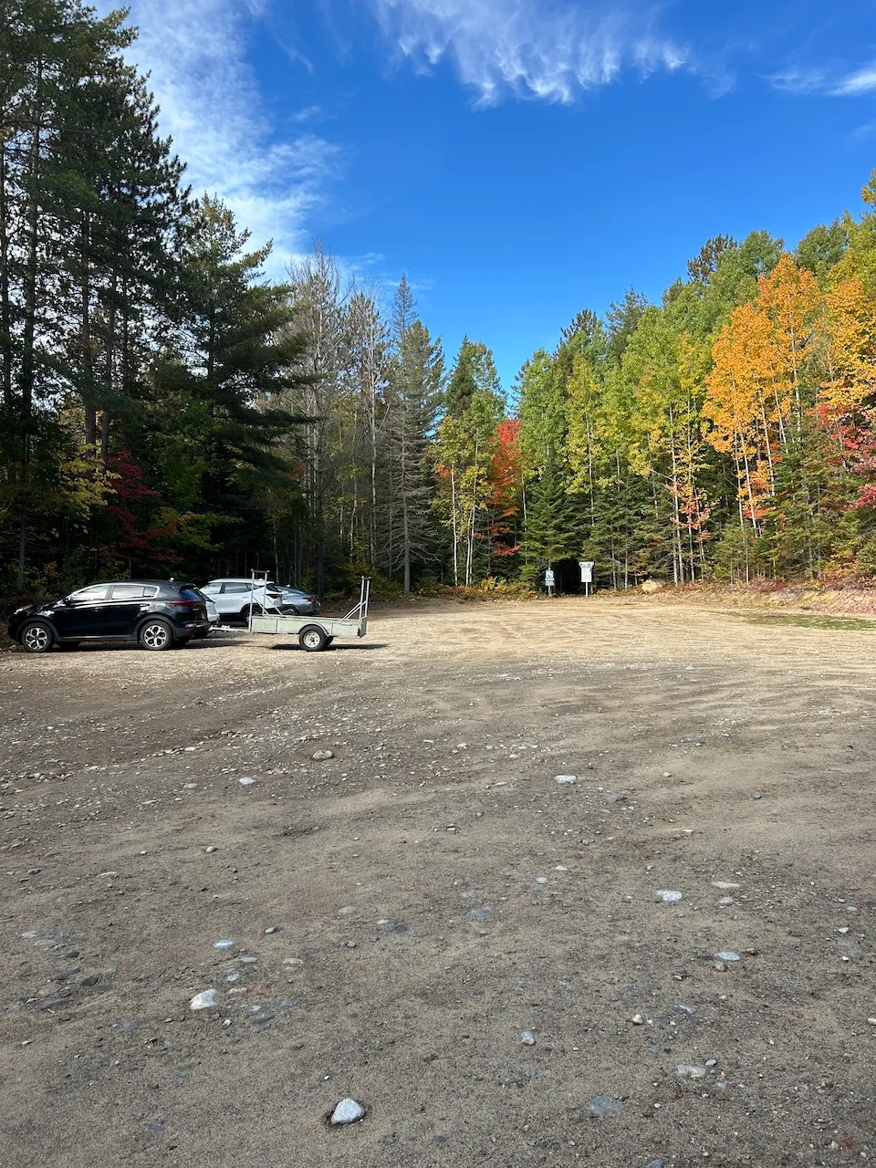
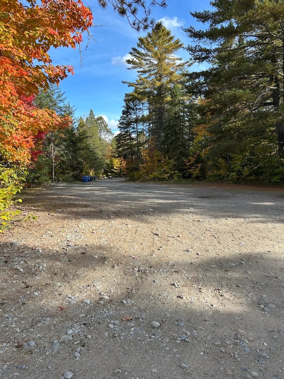
Parking-Information
- Parking type : outdoor
- Number of reserved spaces for people with disabilities : 0
Exterior surface
- Surface type : large gravel
Trail
- Length(km) : 2,1
- Average trail clear width (cm) : under 100 cm
Trail-Elevation
- General elevation change on route : more than 6%
- Steep slope-Percentage(%) : more than 12%
Trail-Surface
- Main surface type : hard-packed earth
- Presence of obstacles : rocks
Additional Information
The trail begins about 40 m from parking lot P2 and starts with a very steep 44% incline on a coarse gravel surface. It then continues into the forest via a narrow dirt path, varying in width from 40 to 60 cm.
The trail has many obstacles, including roots, logs, and rocks, as well as sections with slopes of up to 29%. Educational signs are posted along the trail.
Circulation aisle
- Level : 1 step
Counter
- Surface height (cm) : 112
Exterior surface
- Surface type : large gravel
Payment terminal
- Payment terminal type : wireless
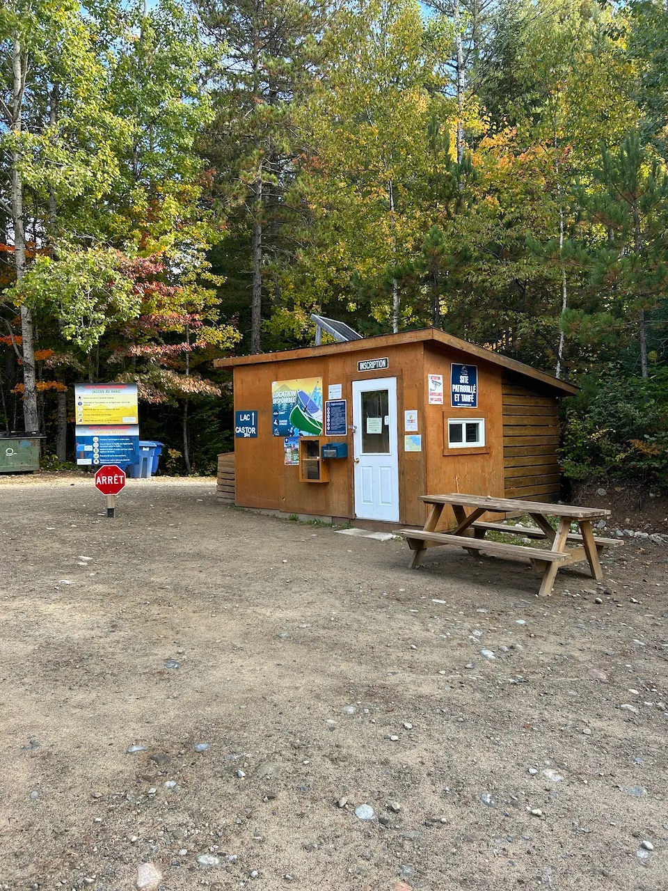
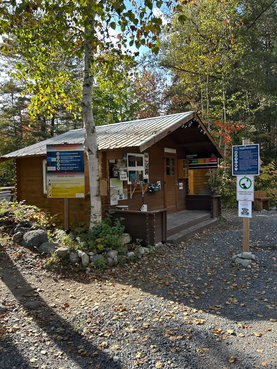
Kiosk type
- Kiosk type : reception
Additional Information
The reception desk is not accessible, but it is possible to purchase daily access directly on the park's website.
Trail-Surface
- Main surface type : compacted stone dust
- Secondary surface type : large gravel
Trail-Elevation
- General elevation change on route : more than 6%
- Steep slope-Percentage(%) : more than 12%
Trail
- Average trail clear width (cm) : over 150 cm
- Presence of obstacles : none
Additional Information
This is a multi-purpose trail connecting the visitor center to the P5 parking lot and serving all parking lots and trailheads. It is used by vehicles, but can also be used by pedestrians and cyclists. The trail is generally gently sloping, although some sections have gradients ranging from 10% to 20%.
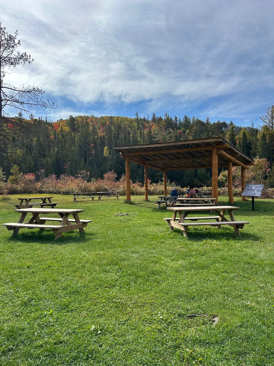
Picnic tables are located near the visitor center, but none are accessible. Dry toilets are generally provided at each trailhead.
Rest area
- Rest area available : no
Trail-Surface
- Main surface type : hard-packed earth
- Secondary surface type : large gravel
- Presence of obstacles : rocks
Trail-Elevation
- Steep slope present : yes
- Steep slope-Percentage(%) : more than 12%
Observation point
- Balustrade height (cm) : 106
Additional Information
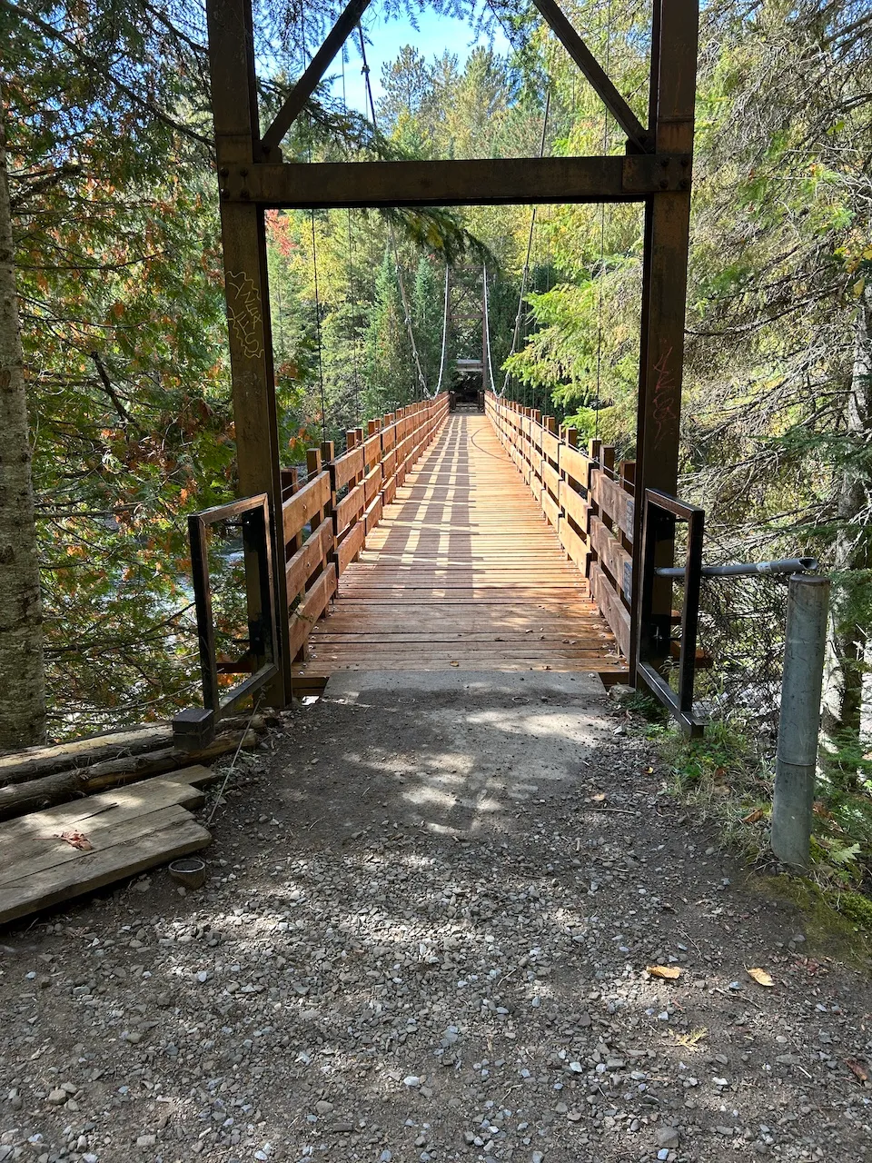
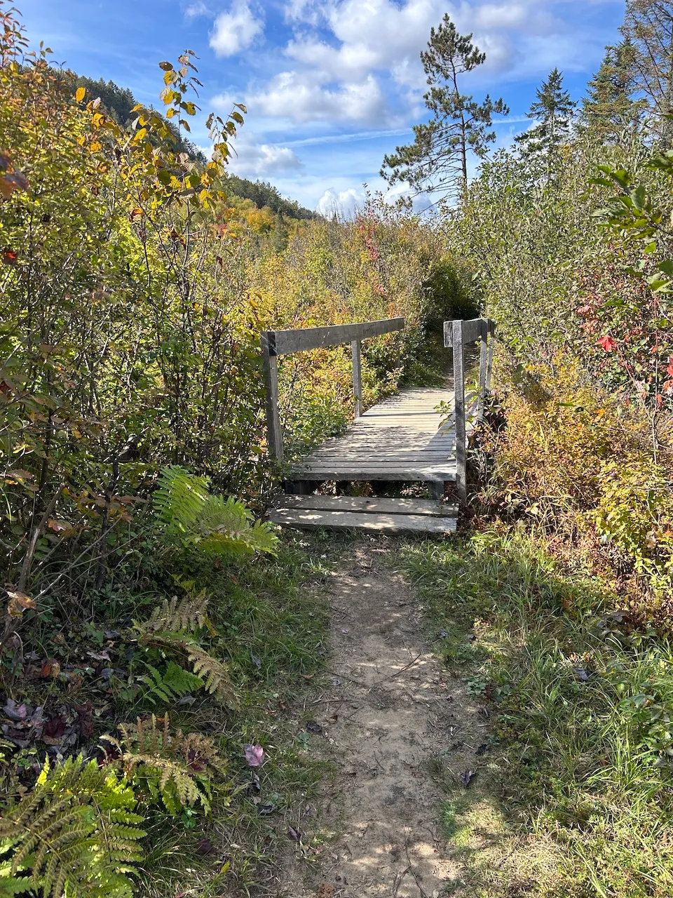
There are two trails leading to the suspension bridge. The first, located near the river and the rest area, is sandy and inaccessible due to several obstacles, including a small bridge with two steps and large rocks along a 0.2 km stretch. The second trail starts directly at the parking lot, near the reception area. It is a dirt trail with steep slopes of up to 30%, with numerous large rocks and roots, covering a distance of approximately 0.5 km.
The suspension bridge has a 4 cm threshold at the arrival point and gaps of approximately 4 cm between the wooden slats.
Circulation aisle
- Presence of slope : no
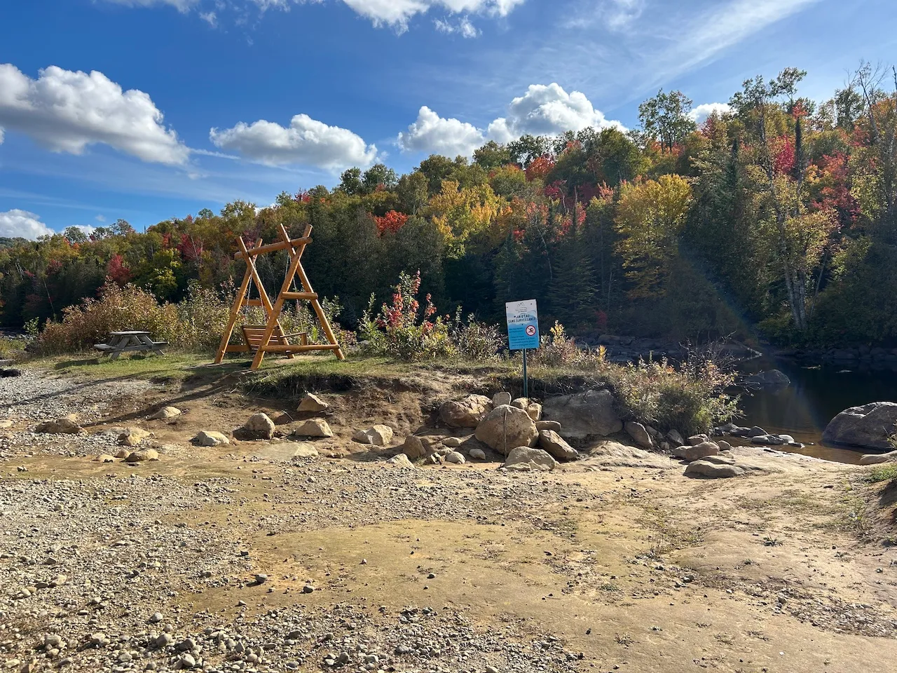
Rest area
- Rest area available : yes
- Type of surface : lawn
Exterior surface
- Surface type : compacted stone dust
Directional signage
- Raised elements present : no
- Braille present : no
Additional Information
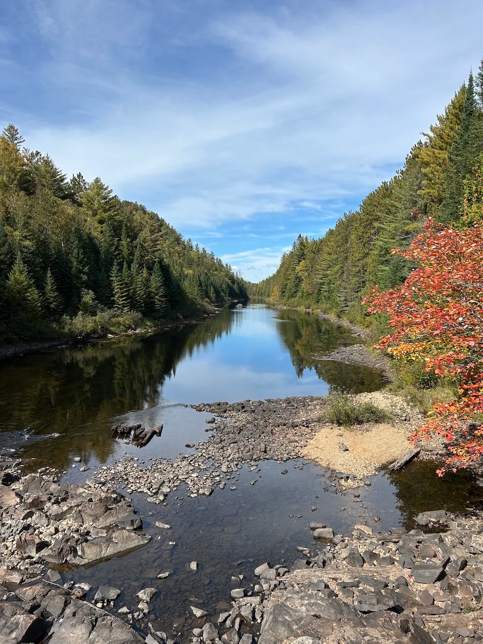
A rest area offering a view of the Ouareau River is located in the immediate vicinity of the parking lot. However, there are no adapted picnic tables available.
Two dry toilets are also located near the parking lot. They have a 19 cm threshold and no grab bars.
Payment terminal
- Access to terminal : large gravel
- Type of interface : digital screen
- Payment possible via online app : yes
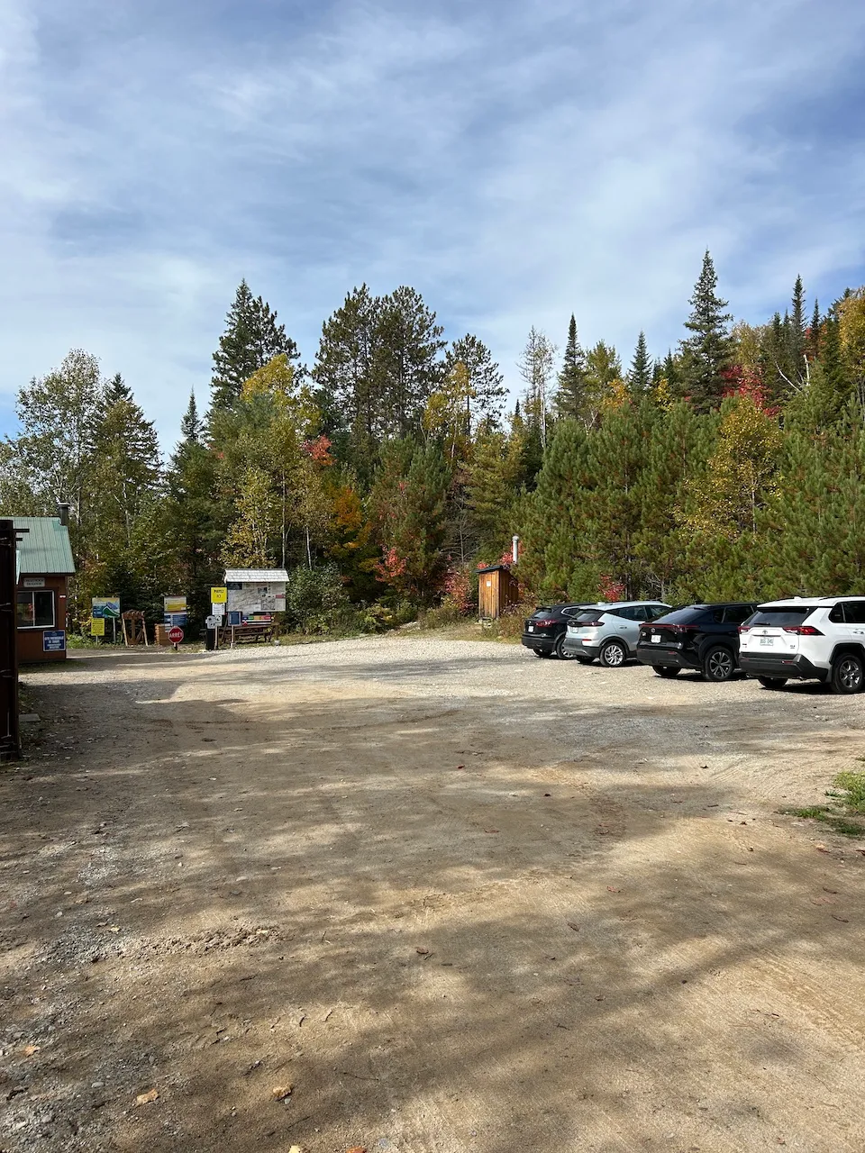
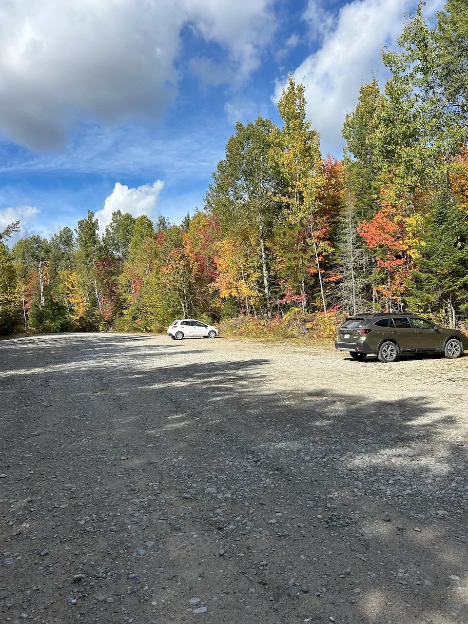
Parking-Information
- Parking type : outdoor
- Number of reserved spaces for people with disabilities : 0
Exterior surface
- Surface type : large gravel
Trail
- Average trail clear width (cm) : under 100 cm
Trail-Surface
- Main surface type : hard-packed earth
- Presence of obstacles : uneven
Trail-Elevation
- Steep slope-Percentage(%) : more than 12%
Additional Information
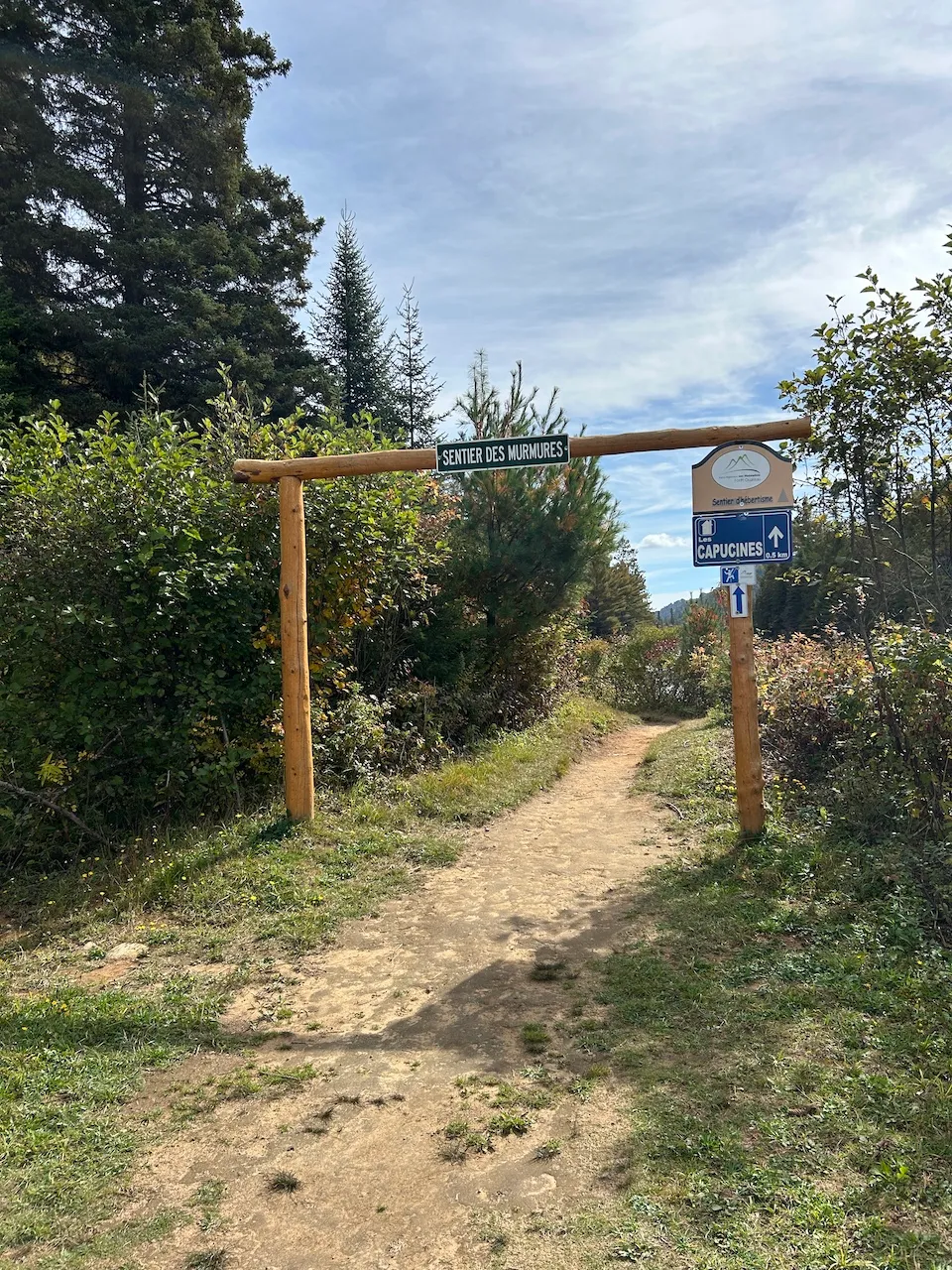
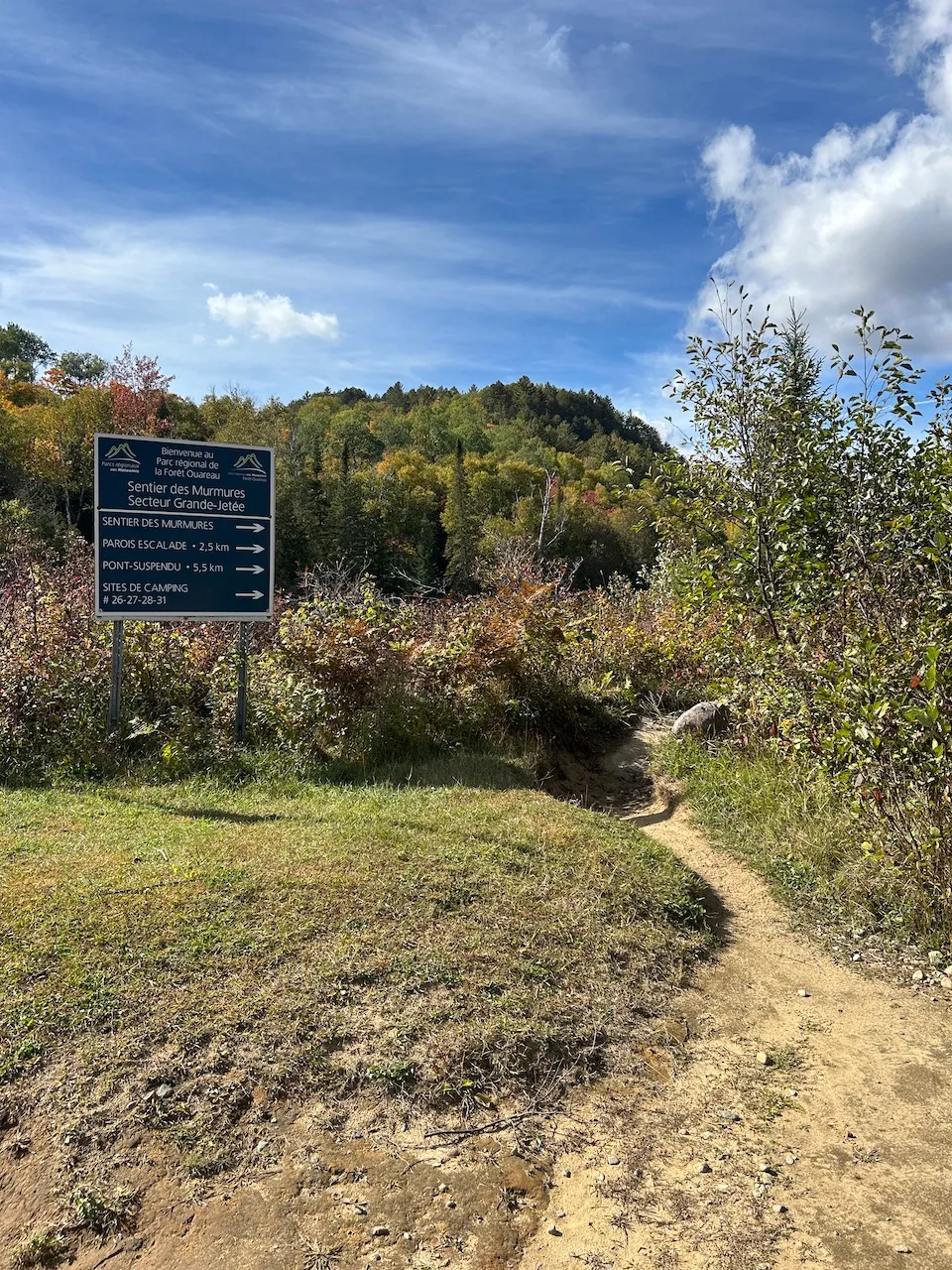
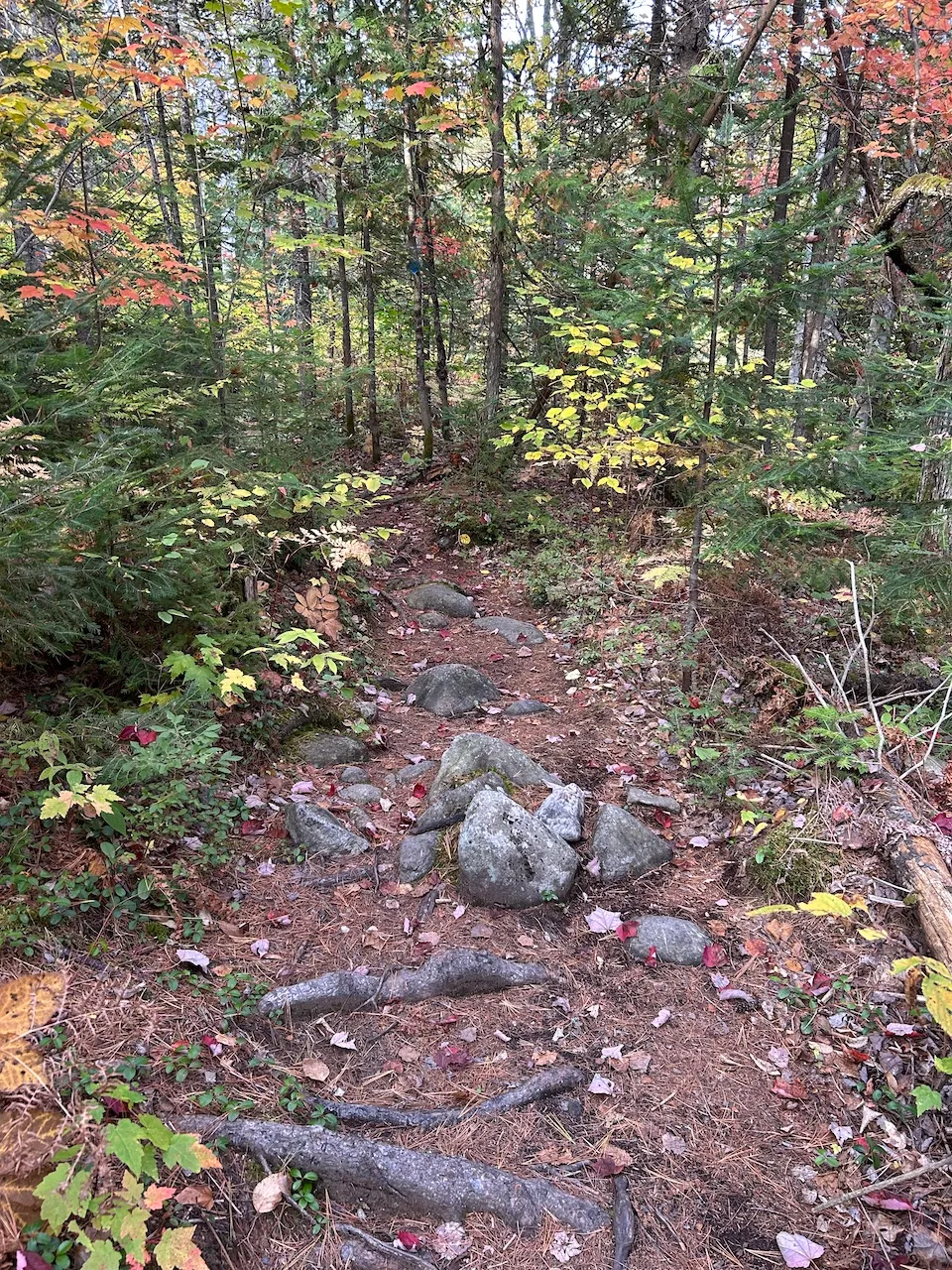
Access to the Murmures trail is possible from the Pont-Suspendu sector and leads to the Grande-Jetée sector. At this location, some sections of the trail are very narrow, approximately 50 cm wide. The trail has slopes of up to 25% and features several steps, large rocks, and roots.
Kiosk type
- Kiosk type : reception
Exterior surface
- Surface type : compacted stone dust
Payment terminal
- Payment terminal type : wireless
Counter
- Surface height (cm) : 126
Directional signage
- Site map showing accessible services/routes : no
- Raised elements present : no
- Braille present : no
Exterior surface
- Surface type : large gravel
Rest area
- Table(s) available : yes
Additional Information
Dry toilet located near the parking lot: 22 cm threshold, no grab bar, and accessible only via a steep 19% slope.
No picnic tables adapted for wheelchair users.
Exterior surface
- Surface type : compacted stone dust
Parking-Information
- Parking type : outdoor
- Number of reserved spaces for people with disabilities : 0
Payment terminal
- Access to terminal : concrete base
- Controls-Height (cm) : 136
- Payment possible via online app : yes
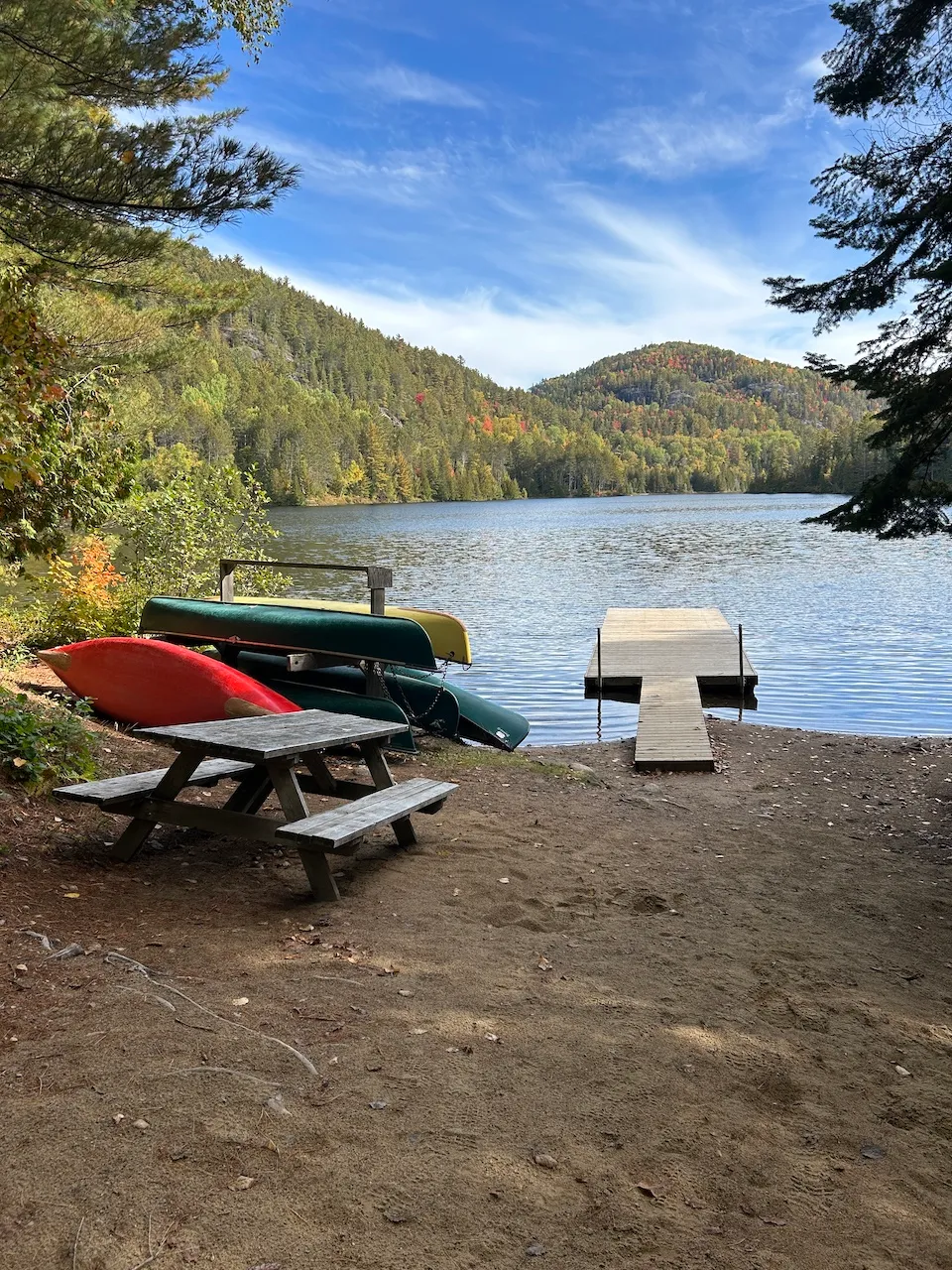
Exterior surface
- Surface type : sand
- Presence of obstacles : rocks
Circulation aisle
- Slope(%) : 17
Additional Information
The route between the parking lot and the lake is approximately 100 feet long and includes a steep 17% slope on uneven ground (sand, rocks, and roots). Access to the dock is via a 76.5 cm wide walkway with no protective edge and a 12 cm threshold between the ground and the walkway.
To rent equipment, the key to the shed is provided by the person at the parking lot entrance or, if unavailable, at the suspension bridge reception desk. The padlock on the shed is located 130 cm above the ground.
No suitable equipment available.
Description
The Ouareau Forest Regional Park is a vast natural area dedicated to outdoor activities, divided into six sectors. The park offers a network of forest trails, most of which feature steep slopes and natural obstacles. No adapted equipment is available for loan and there are no toilets accessible throughout the site. The suspension bridge is not accessible.
2007 chemin du Massif, Notre-Dame-de-la-Merci, Québec
819 424 1865 /
parcsregionaux@matawinie.org
Visit the website